
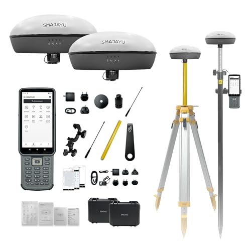
SMA20 RTK PPK GNSS Receiver, 1 cm Accuracy, 1408 Channels, NOAA Certified, Calibration Free, Free Software, Rover Base Collector Connect with UAV Drone for Topographic GIS Surveying
Price may vary by location, shipping cost, and availability.
Price History Information
You can check the price history of SMA20 RTK PPK GNSS Receiver, 1 cm Accuracy, 1408 Channels, NOAA Certified, Calibration Free, Free Software, Rover Base Collector Connect with UAV Drone for Topographic GIS Surveying here.
Product Information
Details
| Product Name | SMA20 RTK PPK GNSS Receiver, 1 cm Accuracy, 1408 Channels, NOAA Certified, Calibration Free, Free Software, Rover Base Collector Connect with UAV Drone for Topographic GIS Surveying |
|---|---|
| Store Product Code | B0H3V3K6W7 |
| Store Name | amazon.com |
| Brand | SMAJAYU |
| Category | Handheld GPS Units |
| Model Name | SMA20 RTK(410~470MHz) |
Features
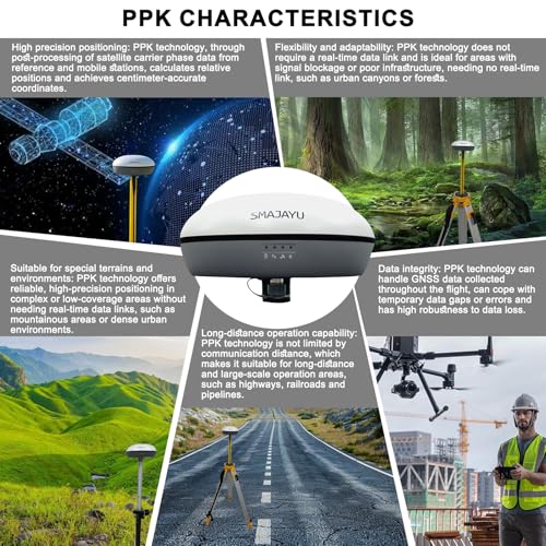
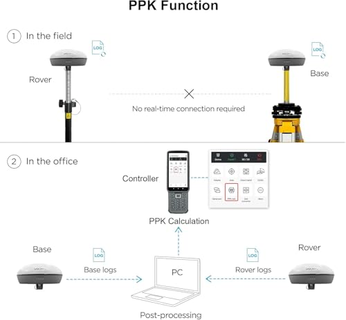
- Advantages: Static &RTK base dual mode,when static surveying simultaneously work as RTK base, enable SMA20 multiple surveying mode capability and high accuracy NOAA certification: SMA20RTK is antenna name of NOAA registered PPK enabled suitable for challenge environment,forest,canyon.. in a long distance 25km PPP method by Galileo HAS correction Rinex logging enabled which can export rinex files directly to PC CORS network connection supported by login a CORS account on collector
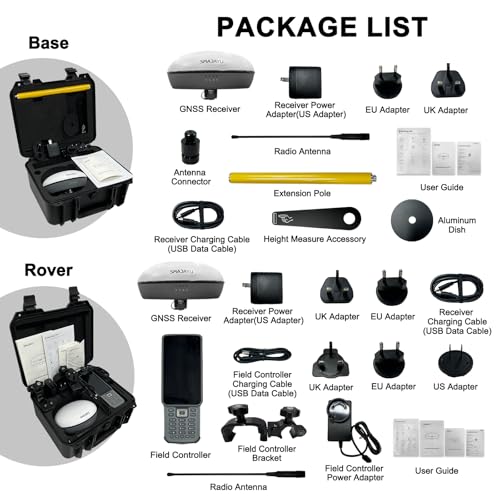
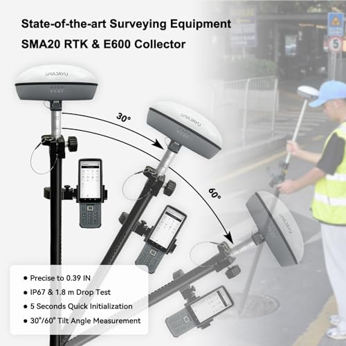
- Capability: Full-Constellation RTK GPS Land surveying equipment Rover+Base+Collector(Software activated). Max 25km distance between rover base by PPK; 1cm RTK accuracy,0.25cm static accuracy 5-8km UHF distance by RTK max. angle 60tilt, 30 tilt 2.5cm accuracy (horizontal) long endurance battery,10hours for base,15hours for rover under continuous work of each battery charge 2.5cm accuracy by PPK method,compatible with SMA26 static equipment; 2.5cm accuracy by CORS
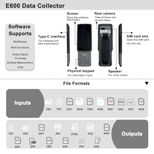
- SMA20RTK GNSS Receiver offers versatile surveying modes to adapt to various project requirements and environments Data output format: RTCM3.X (input&. output), NMEA-0183 (input&. output), CMR (input), RTCM2.X (input) Multiple constellation adaptable to any country and suitable for use in various complex and challenging environments
- RTK Connection: Rover+Base:Connect Collector with GNSS receiver by BT to set rover and base at the same protocol and frequency till RTK fixed. Or Rover+CORS: login CORS account on software till RTK fixed
- Application: The SMA20 RTK GNSS receiver provides the accuracy needed for a wide range of surveying and engineering applications, including topographic surveying, geographic surveying, engineering surveying, agriculture field measurement, mine surveying, construction surveying
Images
× ![]()

* Predictions is created on based of past prices and trends, it does not guarantee that it will happen. These are just prediction for theoretical information only.