
21st Mar 2026, 07:41 AM
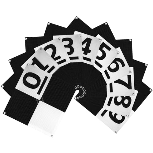
Drone Survey Ground Control Point GCP, UAV Aerial Survey Mapping Target Numbered 0-9, GCP UAV Marker with Center Eyelet and Corner Anchor Points, Compatible with Surveying Equipment, 10 PCS (24 inchx24 inch)
Price may vary by location, shipping cost, and availability.
Lowest ever
93% Off
$54.99
$830.37
Highest: $54.99
Average: $54.99
Lowest: $54.99
Price History Graph
Offer Price Prices
Lowest: -
Average: -
Highest: -
Price History Information
You can check the price history of Drone Survey Ground Control Point GCP, UAV Aerial Survey Mapping Target Numbered 0-9, GCP UAV Marker with Center Eyelet and Corner Anchor Points, Compatible with Surveying Equipment, 10 PCS (24 inchx24 inch) here. This product's current Price in USA is $54.99. The average and highest prices are $54.99 and $54.99 respectively.
| Lowest Ever Price | $54.99 |
|---|---|
| 4th Mar 2026 | |
| Average Price | $54.99 |
| Based on 138 days price tracking | |
| Highest Price | $54.99 |
| 4th Mar 2026 | |
Current Price in USA
| Price | $54.99 |
|---|---|
| MRP | $830.37 |
| Savings | $775.38 |
| Discount | 93.37% |
Product Information
Details
| Product Name | Drone Survey Ground Control Point GCP, UAV Aerial Survey Mapping Target Numbered 0-9, GCP UAV Marker with Center Eyelet and Corner Anchor Points, Compatible with Surveying Equipment, 10 PCS (24 inchx24 inch) |
|---|---|
| Store Product Code | B0F3P2273Z |
| Store Name | amazon.com |
| Rating | 8.8 / 10 |
| Category | Unmanned Aerial Vehicles (UAVs) |
| Product Manufacturer | LuxeVib |
Features
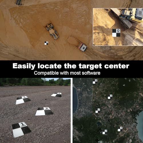
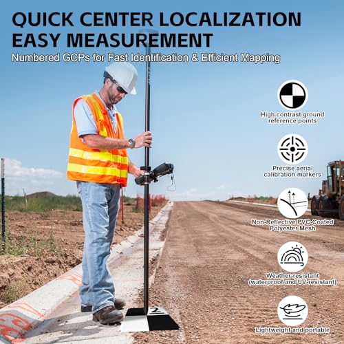
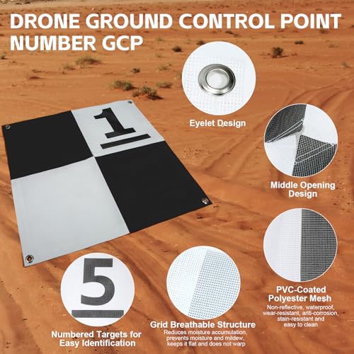
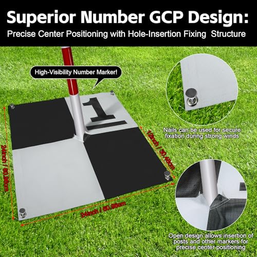
- High-quality Aerial Survey Target: This 0-9 number 10PCS drone control point GCP is not only a precise aerial calibration mark, but also a high-contrast ground reference point. The center opening design makes it easy to directly insert the column to locate the coordinate measurement, or aim the drone camera at the center channel to quickly capture accurate data. This UAV GCP improves the accuracy of data collection and optimizes the efficiency of drone operations.
- Hole Design GCP: The center hole designed on this UAV GCP makes it easy to quickly identify the center of the GCP through the surveying equipment rod to avoid tearing the aerial target. Each corner has holes for easy fixing. The anchor point design supports long-term deployment. When repeated flights are required, it can be left on site without repositioning, ensuring that the GCP provides high-precision and repeatable position data, which is suitable for precise surveying, photogrammetry.
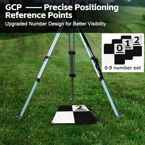
- Efficient Surveying Number GCP: This UAV GCP set features clear, rounded, and eye-catching numbered markers that ensure quick and accurate identification from aerial imagery. The black-and-white checkerboard pattern enhances visibility under various lighting conditions, while the distinctive numbering improves recognition efficiency and data alignment. Compatible with most photogrammetry and auto-recognition software, it boosts survey accuracy and operational efficiency in the field.
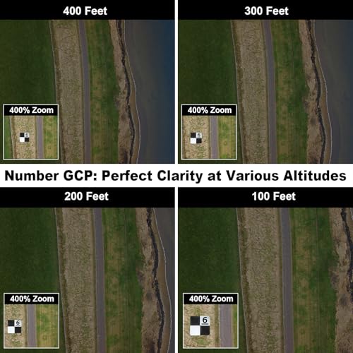
- Affordable Number Set Ground Control Point: This 24x24 ariel survey targets is designed for low to mid-altitude UAV mapping and scanning, suitable for flight altitudes up to 400 feet. Compared with homemade UAV GCPs, our design has advantages in performance and economy. Standard size facilitates map scaling and verification, and provides accurate reference distances for post-processing. We ensure a more efficient and cost-effective GCP aerial survey target solution.
- Premium Fabric for GCP: The survey Mapping Target is constructed with PVC coating reinforced by a polyester mesh. The matte finish design reduces sunlight glare and overexposure, facilitating accurate selection of the target center. The drone GCP is lightweight and clearly visible, suitable for travel and field setting of UAV ground control points. Compared with traditional DIY solutions, its performance is more stable and reliable, and it is an ideal choice widely recommended by the industry.
Images
× ![]()
Rating and Reviews
8.8 Based on 12 reviews
Drone Survey Ground Control Point GCP UAV has 8.8 rating out of 10. This average rating is consist of 12 individual ratings. You can rate this product at product review page.
* Predictions is created on based of past prices and trends, it does not guarantee that it will happen. These are just prediction for theoretical information only.